


|
Wednesday, 11th August, 2010
|
|
|
Bourbonhamna & Recherchefjord,
Bellsund
“On 25th (1848) July La Recherche cast anchor in Bell Sound. Here a grand and terrible panorama opened to our view; I wish I could describe its gigantic proportions and wonderful beauties.”– Xavier Marmier, in Spitsbergen Gazette, 20 July, 1887
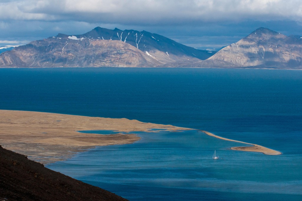
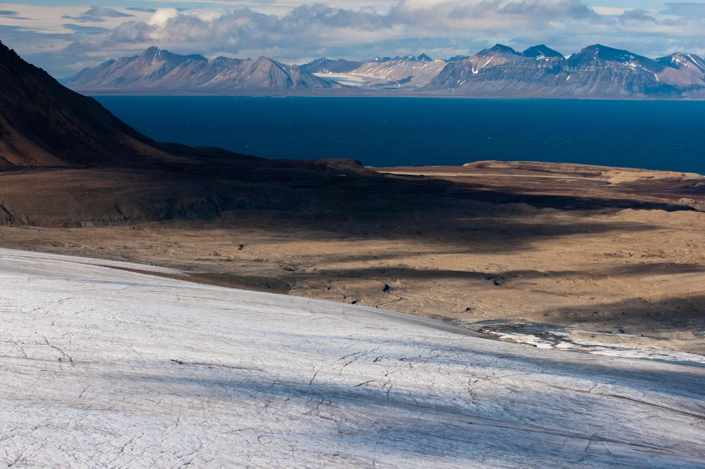
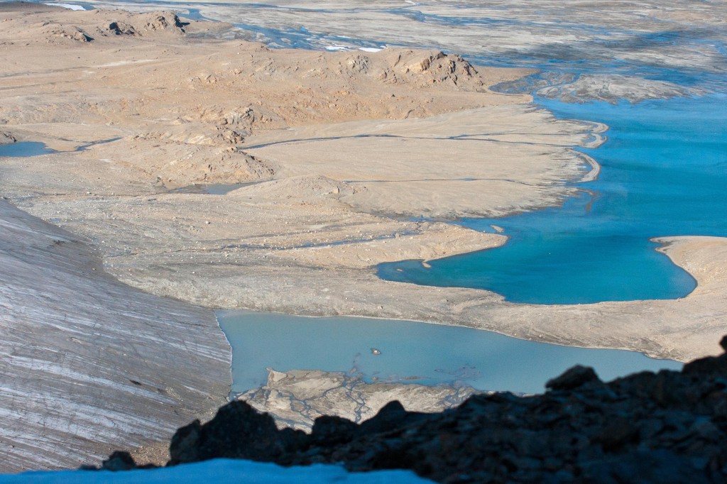
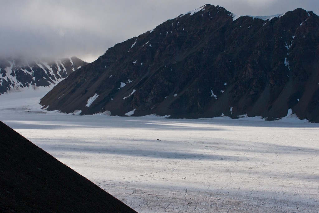
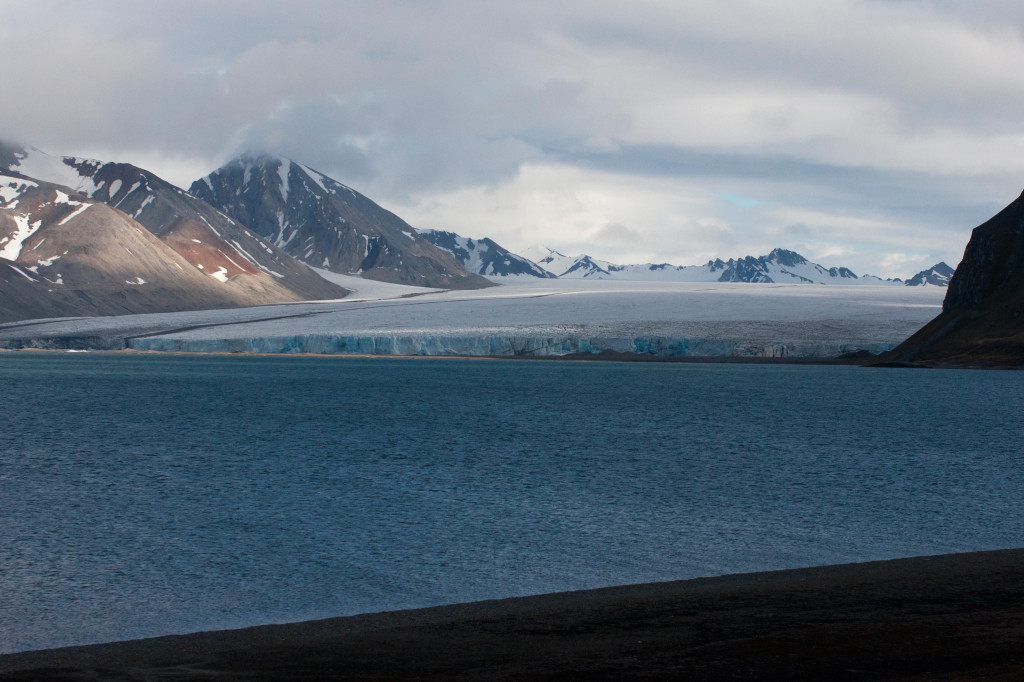
Bellsund is dominated by high peaks and convoluted rocky cliffs, interspersed with glaciers, their glistening lines flowing silently through the ancient, carved valleys. Bellsund, named after its bell–shaped mountain, Klokkefjellet, is around 20 km wide at its entrance. The fjord complex, with its two branches, extends up to 80 km inland. Today will be spent exploring Van Keulenfjord and the southern shore of Bellsund, with the opportunity of a picturesque landing in the morning and an extended walk in the afternoon.
|
|
|
0630 |
Early morning tea, coffee and pastries are available in the Lounge/Bar |
|
0700 |
Wake-up call |
|
0730 |
Breakfast is served in the Dining Room |
|
0900 |
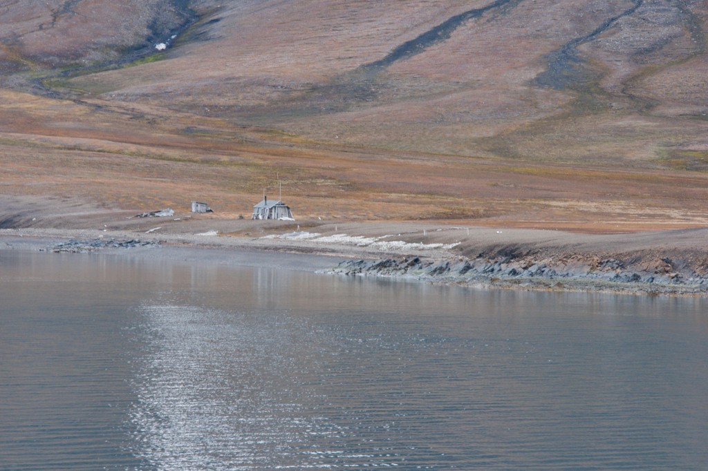
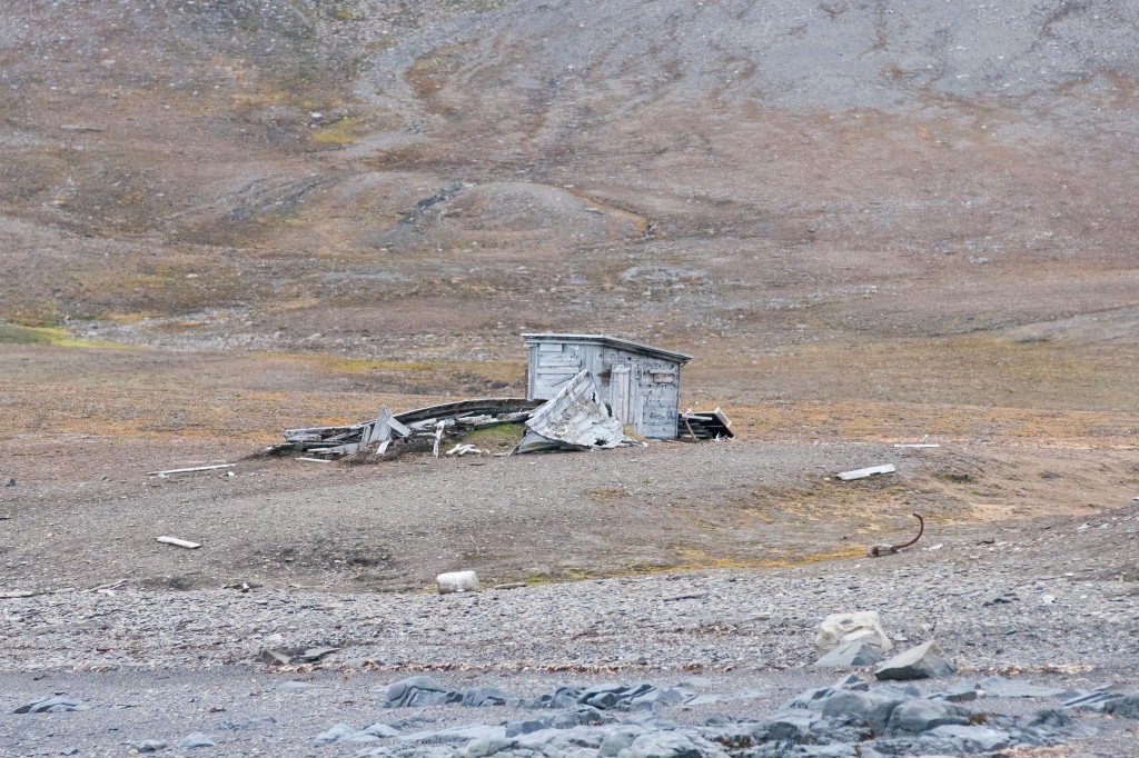
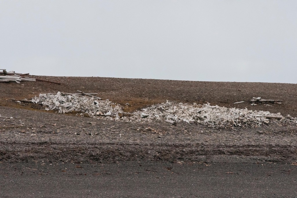
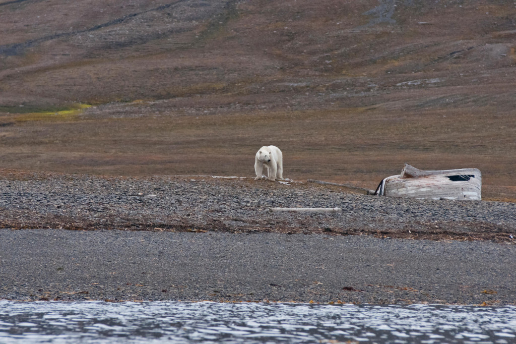
We hope to land at Bourbonhamna, Van Keulenfjord This bay was named for its royal visitor, the Prince of Bourbon, who helped chart this area in his yacht (Fleur de Lys) in 1891-92. At the landing site, the well maintained hut, Bamsebu (home of the bear) is still used to this day, but no longer for hunting. This austere setting is littered with the remains of 500 belugas, just some of those that were hunted in the 1930’s. Boats from this time lie upturned on the beach, slowly being claimed back by the environment. Geologically significant in this region are the highly deformed basement rocks (metamorphic carbonates) and also the folds in the sedimentary layers from the Carboniferous and Permian periods.
|
|
1230 |
Lunch is served in the Dining Room |
|
1400 |
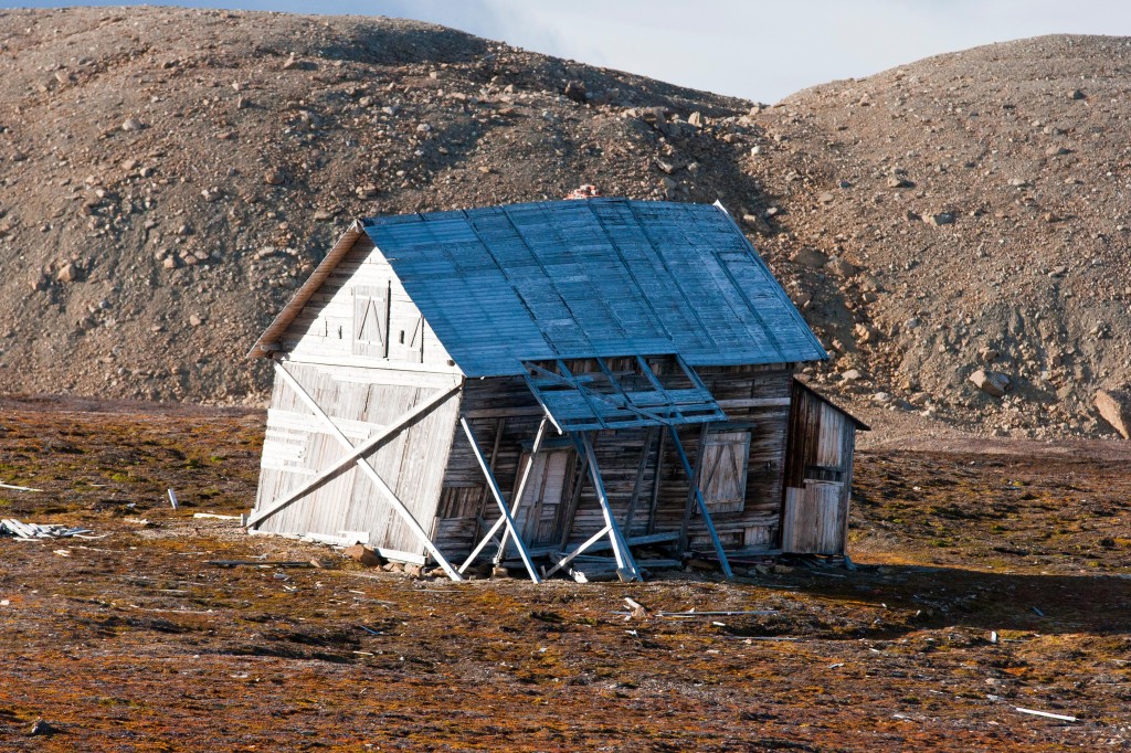
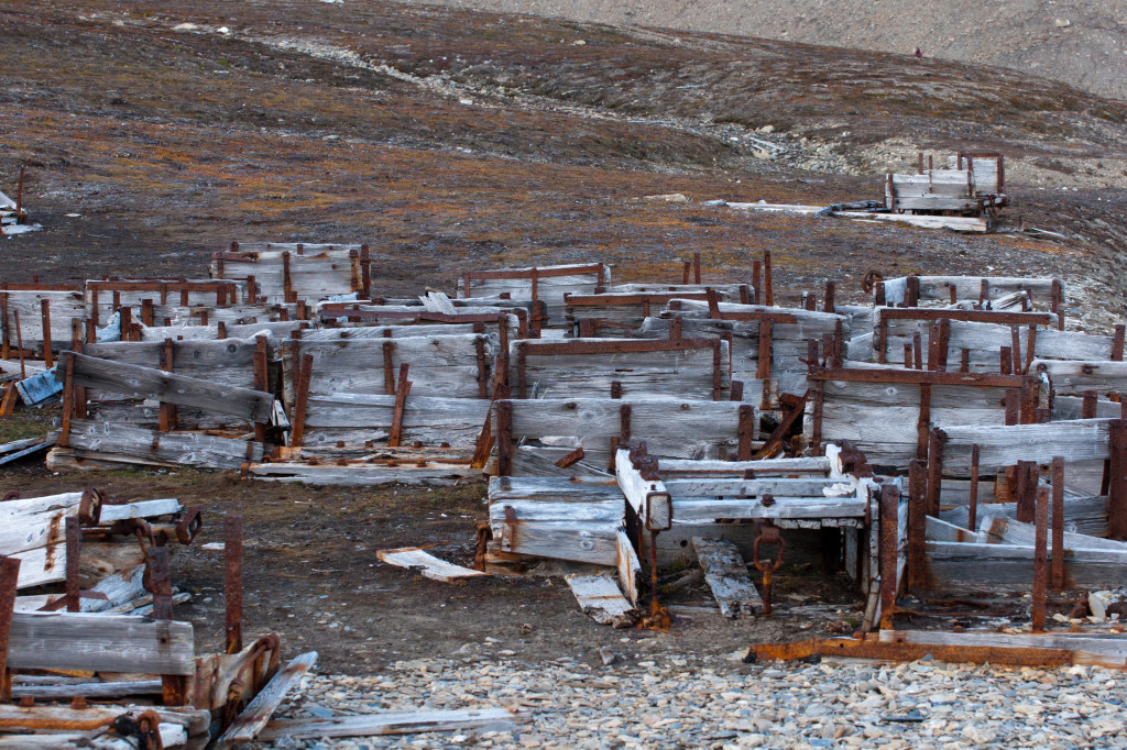
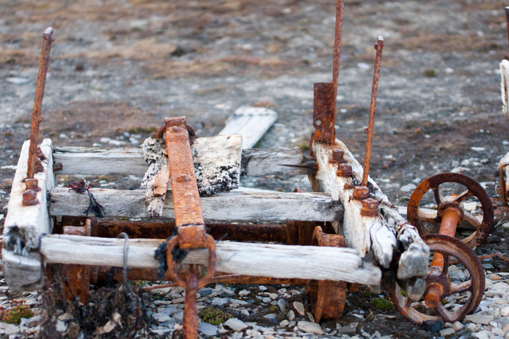
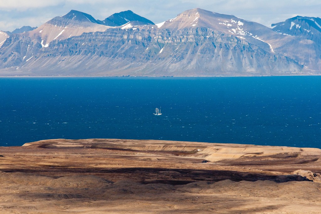
We hope to land at Recherchefjord in Bellsund Our afternoon’s destination is Recherchefjord (Research fjord), a small, 8 km fjord named for the ship La Recherche, used by the French scientific expedition in 1838 for charting much of this area. This site is also historically significant, being used for many commercial ventures including whaling, mining, trapping and tourism. English and Dutch whalers were here as early as 1612-13, with one group becoming the first to overwinter in Spitsbergen in 1630 after being inadvertently left behind. Pomors were on this site in the 18th century, the foundations of their huts now reduced to raised mounds attracting lush vegetation. Prominent on this site is the large, leaning hut, Gjævervilla, built in 1904, with the intention of appealing to hunting tourists. This, along with the mining ventures of the Northern Exploration Company (England), was unsuccessful. The mining carts, lying abandoned on the beach, are testimony to those seeking their fortune in this challenging wilderness. Above the hut are the graves of some of those who met their demise in this area. As we walk in this lush tundra area and along the shore, we may see reindeer, grey phalaropes, purple sandpipers and Arctic skuas.
|
|
1630 |
Afternoon tea is served in the Lounge |
|
1830 |
Maxwelcomes you to the Bar for Happy Hour |
|
1930 |
Dinner is served in the Dining Room |
|
2100 |
Film: Please join Tony for the BBC nature documentary “Planet Earth” |
|
Your “Favourite Photos” may be placed onto the computers in the Presentation Room until 2100 tonight. Thank you for sharing a few of your photographs. |
|
|
|
|
|
|
|